Having experienced the salt flats, we gave ourselves 2 nights to recover and get reorganized in Uyuni before moving on. While in Uyuni we made a quick day trip to Pulacayo, a mining semi-ghost town nearby. Nestled in the hills above the salt flats, Pulacayo serviced one of the largest silver mines in Bolivia. Now, with the mine finished Pulacayo’s population has been reduced to only a few hundred living amongst the decaying and rundown buildings. We jumped off the bus, and walked through a guarded fence to enter town. We were initially greeted by some decaying trains. We continued in and wandered around the old streets lined with warehouses and shops, a former police station, church, and residences. There was even a mansion. It was like we’d walked into an apocalyptic scene at the end of the world complete with the last few survivors. Every once in a while a random resident would pop out of a door and wander down the street. Most doors were locked shut so we were limited in our ability to poke around but it was an amusing visit nevertheless. We were the only foreign visitors and the town still gets relatively few despite being so close to Uyuni which sees thousands. Thus Pulacayo doesn't really have much tourism infrastructure set up yet other than a couple signs and a closed office that is probably more administrative/preservation related than touristic focused.
 |
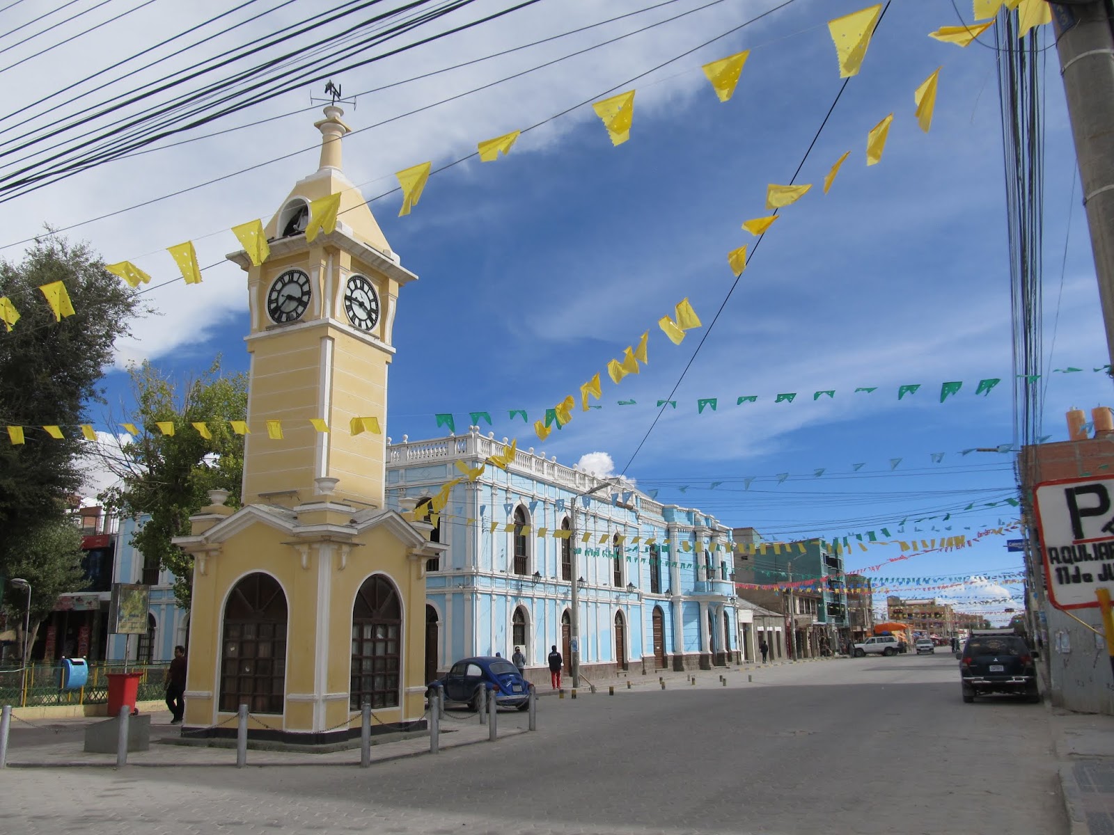
| Clock tower, Uyuni |
 |
| Pulacayo |
 |
| All abandoned |
 |
| Seen better days... |
 |
| Former mansion |
From Uyuni we continued to Potosi for a couple of days. At 4100m we were back to being out of breath and still freezing at night. Breathing was bad enough at altitude but Potosi’s public transit is run by an army of small buses that pump out so much pollution we were afraid to walk down the street lest we choke and die.
Much of the wealth of the Spanish empire was the result of silver mined from Cerro Rico, the mountain towering over Potosi. It was the largest silver mine in the world from shortly after its discovery in the mid 1500’s until 1800 when a decline in silver resulted in a shift to other minerals. Tens of thousands of local slaves died in the mines. The riches were eventually transported to the pacific coast, shipped up to Panama and loaded onto the Spanish treasure fleet to return to Spain. We’d finally made it to the source of a significant part of that Spanish treasure the pirates were after. Of course some of that wealth stayed in Potosi and there are some impressive colonial buildings still standing today, especially around the central plaza and the historic centre surrounding it. We went on a tour of the old mint, to learn about the development of the minting of coins there over a period of a few hundred years. There are still the original mule-powered machines used to press the silver bars into the correct thickness before stamping out the coins along with other interesting artifacts.
 |
| On the road to Potosi |
 |
| Random market life |
 |
| Central plaza and main cathedral |
 |
| Enjoying the sun |
 |
| San Lorenzo church. These ornate facades are very common here |
 |
| Lots of little balconies |
 |
| Cerro Rico overlooking town |
 |
| Outdoor foosball is very popular here |
Today, Potosi is still reliant on mining but the mines are owned by miner cooperatives and as many as 15,000 miners still work in dangerous and primitive conditions hoping to find enough silver to pay their bills. Life expectancy is low and there is even a concern that the mountain is so dug out at this point that it could collapse completely. Most visitors to Potosi come for the tours of the mines but we had no intention to visit and didn’t go.
From Potosi we continued a few more hours down the road to Sucre. It was another beautiful drive. The scenery in Bolivia has been stunning everywhere we’ve gone. Who knew there were so many different types of mountain scenery out there? Sucre is the constitutional capital of Bolivia but apart from the judiciary, the de facto capital is now in La Paz. Sucre is nicknamed the white city, is often considered the most beautiful city in the country and many visitors stay longer than planned. We fell victim as well, staying a couple extra nights and taking it easy. Sucre has many colonial buildings and old churches and we enjoyed relaxing in the plaza, people and pigeon watching.
March is the end of the rainy season as well and Sucre was where it really started to affect us. From that point on we were getting regular rain/thunder in the afternoons.
 |
| Main cathedral of Sucre |
 |
| White city indeed. |
 |
| Grabbing a meal at the central market |
 |
| People watching in the central plaza |
On the edge of town is Cal Orck'o, the site of the world’s largest collection of dinosaur footprints. Over 12,000 footprints from multiple dinosaur species have been documented on site. The area was once the shore of a lake and over time it dried out, fossilized the footprints and then turned into a nearly vertical wall in the middle of an active cement quarry. The footprint section is 1.5 km long and they are trying to preserve it as best they can with limited resources and options. Some prints have since worn away and others have been lost when sections of the wall have collapsed, only to reveal new ones. We could see the photos fairly well from the street but opted to try to see them better from in the little museum attached. It didn't add much to the experience unfortunately because we missed the time where they take you down close to the face of the wall.
 |
| How many dinosaur tracks can you see? |
 |
| At the dino park |
 |
| Views from Cal Orck'o |
Leaving Sucre on a night bus we got busy once again. We arrived in La Paz just after 8am and have just enough time to get organized, dump our bags and jump on a day tour to Tiwanaku leaving at 9am. That's efficient right? Pass out for the 1.5 hour ride there then follow the group around for the next couple hours. Tiwanaku is the most important archaeological site in Bolivia and is a set of pre-Incan ruins (from the Tiwanaku civilization) that once sat on the edge of Lake Titicaca which is now 15km away. It has not normally been our thing to take tours to ruins but in this case it actually worked out for the best because there was very little signage or anything to make sense of what we were seeing and there is a fair amount of symbology we wouldn't catch either. The ruins weren't anything mind-blowing and are only partially reconstructed but their regional significance has put them on the Unesco map as well.


0 Comments:
Post a Comment
Subscribe to Post Comments [Atom]
<< Home